By Suzanne Webel
Prologue, written in October 2017. Recently I’ve spent a lot of time (again) learning about elk, this time in the context of Rabbit Mountain. In the past few years a growing herd of elk has decided that Rabbit Mountain is a great place to hang out. In spite of Boulder County Parks and Open Space’s mission of providing a haven for wildlife with no hunting, Colorado Parks & Wildlife (CPW) has decided there are too many elk. So they imposed an elk hunt that will close the park to the public for half of every week, for half of every year, so that two hunters a week can have the entire park to themselves while they “harvest” a couple dozen animals a year. The theory is that hunting will inconvenience the elk into migrating off Rabbit Mountain.
Whether trails actually inconvenience wildlife seems to be a perennial debate. Over the years we have asked for new trails on many BCPOS parks, and been told repeatedly that trails inconvenience wildlife so we can’t have more trails. Here, we suggested that staff should build at least the trails that have already been approved, especially if the goal is to inconvenience the elk. The first Rabbit Mountain management plan was written in 1984, when the park consisted of about 560 acres, and the plan promised some really nice trails. One short trail was built. By 1995 when the next management plan was written, the park had grown to more than 2400 acres, and more trails were promised. One short dead-end trail was built. In 2013 an updated management plan was started and more trails were under discussion, but the plan got sidelined because of The Flood. The park now comprises approximately 5,000 acres, including Indian Mountain to the west, a conservation easement at Dowe Flats, and several smaller fee parcels on all sides of the original area. However, staff has not only declined to resume the comprehensive planning process but also now insists that there will “never” be any new trails at Rabbit Mountain. Really? Why not? Can’t have it both ways, staff!
Anyway, in the interest of inspiring equestrians to ride at Rabbit while you still can, I decided to update and republish my original (1996!) Rabbit Mountain Open Space trail log. I thought that I’d have to do a lot of revisions to the text, but alas – nothing has changed in more than twenty years in spite of the park having more than doubled in size. The recreation opportunities are vastly greater today but the arguments against us are still the same, in spite of all the promises.
The park was re-named the Ron Stewart Preserve at Rabbit Mountain in 2017 to honor the vision of Ron Stewart, Parks & Open Space Director for many years.
Mostly-original text from 1996, with just a few new editorial comments [in brackets]. These are exciting times for multi-purpose trail users on Boulder County Open Space. The program is adding vast new territories daily to its domain. BCPOS managers have forged creative alliances with Great Outdoors Colorado (the lottery money people), the Bureau of Land Management, and other conservation organizations to acquire the land and develop new trail systems on some portions of some of these properties. One of the County’s “old standbys”, Rabbit Mountain, has just gotten a facelift in the form of a spectacular [actually, small] new loop trail, thanks to funding from GOCO and a bunch of trail construction volunteers from the Boulder Mountainbike Alliance (BMA) and a few BCHA members including yours truly.
The rocks exposed in the park range in age from the red Permian Lyons sandstone (which comprises most of the buildings at CU), the colorful Jurassic Morrison formation (read, “dinosaurs in swamps”) through the Cretaceous Dakota sandstone (think “beaches”) and the Pierre shale (“great inland sea”). The core of Rabbit Mountain is an anticline made up of these sedimentary rocks that were folded upwards into an arch, or anticline, approximately 70 million years ago. Since oil is often trapped in anticlines, two exploratory wells were drilled in the early 1900’s along the axis of the fold but were abandoned as dry holes. The core of adjacent Dowe Flats to the west is a downwarp, or syncline, from which large amounts of Niobrara limestone are being quarried for cement; when depleted, the area will be reclaimed and turned over to Parks & Open Space. Several breaks in the earth’s crust, or faults, have complicated the picture, shoving older rocks over younger rocks and moving the entire complex sideways in a series of “en echelon” fault blocks east of the main trend of the Foothills. These faults may still be active today, as they bring water up from deep aquifers to the surface and form several springs on both sides of the structure at Rabbit Mountain. [Although the rocks haven’t changed in 20 years, the subsurface interpretation really has; the attached geologic cross section reflects more current information.]
Rabbit Mountain represents a unique juxtaposition of plains and foothills attributes. Native Americans were very active in this area, as evidenced by numerous stone circles, tepee rings, game drive walls, and shelters. The first settlers arrived in the early 1860’s and set up extensive farming and ranching operations.
Also of interest is the large Northern Water Conservancy District canal that tunnels through the heart of Rabbit Mountain and brings water from the Western Slope, underneath Rocky Mountain National Park, to the parched eastern plains.
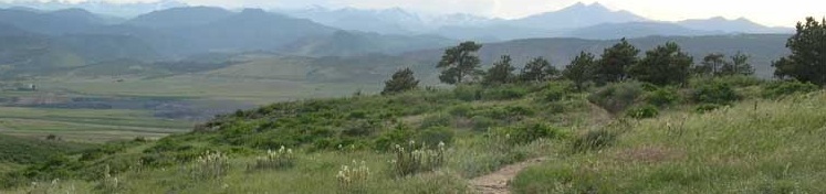
Notwithstanding the intense human activity that has taken place here, Rabbit Mountain is home to several rare species of animals and plants. Today it offers a remote-feeling, exhilarating Open Space experience. Equestrians are allowed off-trail except in places that are specifically closed to the public.
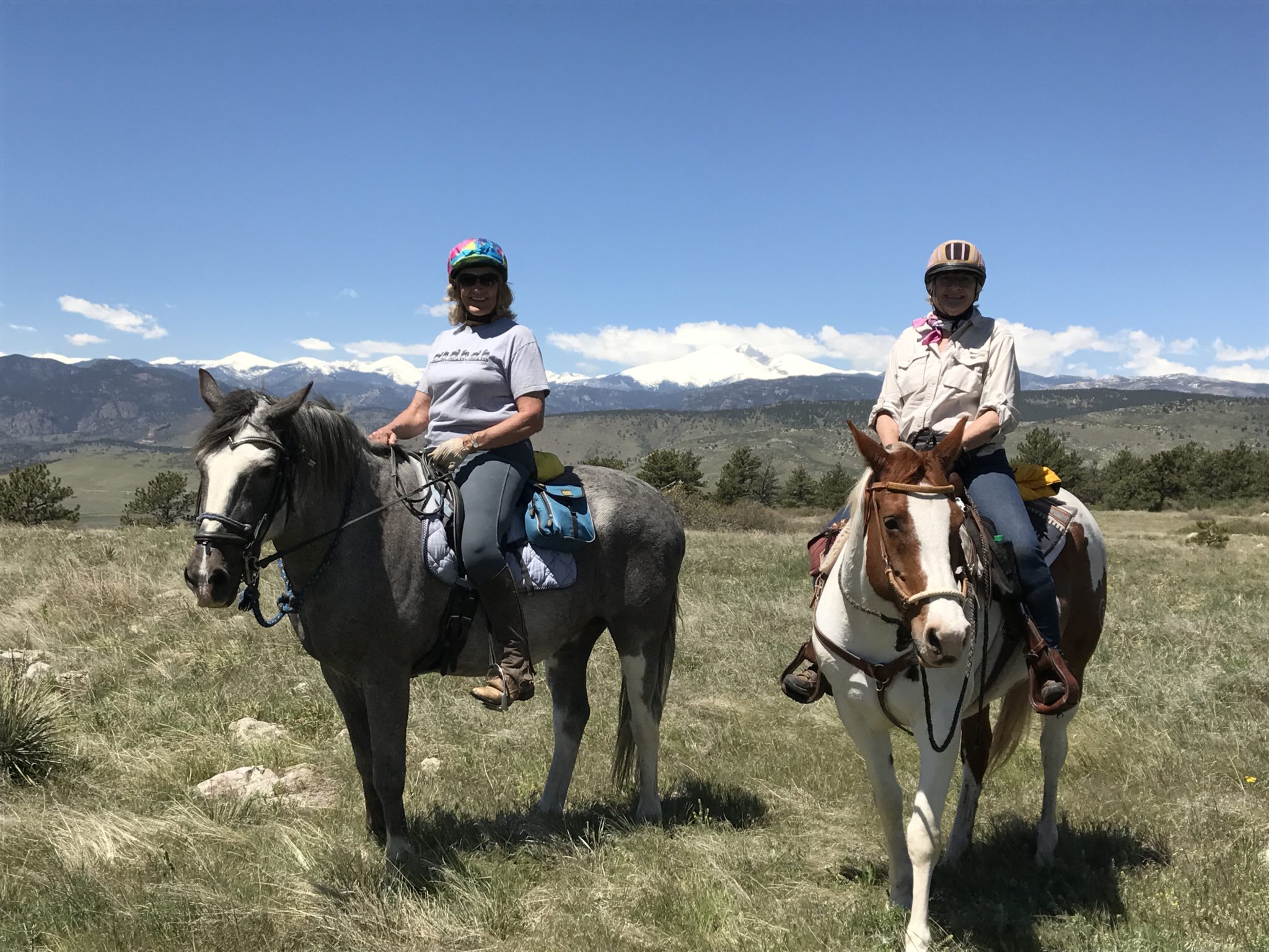 The only access point for this entire park is the trailhead on N55th St about two miles north of Hwy 66. It has ample parking for many cars and three horse trailers, as well as restrooms and picnic tables. Proceed up a short singletrack trail or on the gravel road maintained by Northern Water. As you approach the open topographic saddle, turn right onto the “Eagle Wind” trail. You may notice a faint old road here that was built to access the two wellsites, which are marked with a steel pipe; it can still be used as a trail by pedestrians and equestrians, but not mountain bikes. Meander through ponderosa pines and dense thickets of mountain mahogany, past a rock wall that may have been constructed by prehistoric peoples to drive wild game to its demise. You will be rewarded with splendid views of Long’s Peak and the foothills. The Eagle Wind loop trail forms a relatively short but varied 2.0 mile trail [an extended loop trail was promised in 1995 that would lead from the south end of Eagle Wind to a nice overlook, but its future looks dim now because, well, elk]. There is also a seasonal closure on the entire southeast quadrant of the park to protect nesting eagles from December 15 through July 15 [this is a major reduction in public access, because when this trail log was originally written the closure was “only” from May through mid-July, and the closure is far larger than necessary according to Federal guidelines for eagles]. Continue around the Eagle Wind Trail and rejoin the Northern Water road at the topographic saddle.
To extend your ride, proceed northeast down the “Indian Mesa Trail,” a.k.a. the Northern Water road. There are several old ranch roads in this area that have historically been popular with equestrians (arrows on map), and could offer future possibilities for trail connections with Woodland and/or Yellowstone Roads to a long-promised trailhead there [but which are now mostly dead-ends because of the eagle closure]. Rejoin the gravel road and proceed to the north property boundary — a gate and cattle guard across the road — then return to the saddle. From here you can proceed north on the Little Thompson Overlook Trail, along the base of the sloping sandstone layers out to a sheer drop-off. Peer over the canyon and proceed back a bit farther to a fence marking private property. [Some day a regional trail may connect Boulder County’s Rabbit Mountain Open Space to Larimer County’s Blue Mountain Open Space, but I doubt I’ll still be around to see that happen.] Return once again to the topographic saddle, and to the parking lot, via either the road or the trail.
[Stay tuned but don’t hold your breath for a trail extension from the existing Rabbit Mountain trailhead three miles south along N. 55th St. to the big water tank on Highway 66, where another trailhead parking lot may be built. As noted above, additional plans also include extending a trail or trails around the northeast side of Rabbit Mountain to a new trailhead at the intersection of Woodland Rd. and N. 75th St. and/or Yellowstone Road, and another loop on the northwest corner of the property connecting the Little Thompson Overlook Trail and the trailhead parking lot. Wouldn’t that all be nice? If you want any of these new trails to be built, please get involved with advocacy for them. I’ll be happy to help!]
Total distance: approximately 10 miles including dirt roads
Total time: Approximately 4 hours
Difficulty: Moderate
Dogs: Leash only
Jurisdiction: Boulder County Open Space