Reflecting On–And Planning For–Wildfire Season
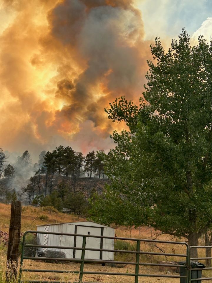
Stone Canyon Fire, Boulder County July 2024
Reflecting On–And Planning For–Wildfire Season Read More »
Stone Canyon Fire, Boulder County July 2024
Reflecting On–And Planning For–Wildfire Season Read More »
By Brittany Steffensen What if sport shooting was eliminated on US Forest Service (USFS) land in Boulder County and neighboring counties to the north and south? As equestrians who escape into the mountains for fun filled weekend trail rides, how would this impact your visits to the Front Range? With the rapid population growth and recreational use along the Front Range, recreational sport shooting on National Forest lands has become increasingly popular, bringing with it rising concerns about safety of all persons enjoying these lands. A collaborative, interagency solution has been in the works for many years through the efforts of the Northern Front Range Recreational Sport Shooting Management Partnership (NFRRSSMP). Their goal is to provide safe, responsible, and accessible recreational sport shooting opportunities while addressing conflicts between multiple recreational users on USFS lands across the northern Colorado Front Range. On February 8th, the board of directors of BCHA had the pleasure to sit down and hear from Mr. Gary Sanfacon, the Project Coordinator for the NFRRSSMP. As a Boulder County native, Sanfacon is honored to serve as the point person for this partnership between Boulder, Clear Creek, Gilpin, and Larimer counties, in addition to the U.S. Forest Service, Northeast region of the Colorado Parks and Wildlife, Arapahoe and Roosevelt National Forest, and Pawnee National Grassland. Sanfacon, too, has been impacted by sport shooting in the mountains of Boulder County. He shared that the ultimate goal for NFRRSSMP is to remove sport shooting (not permitted hunting) on Boulder County’s national forest land by providing a public
By Clare Tone Download the free U.S. Forest Service (USFS) Motor Vehicle Use Maps first! The USFS has established official Motor Vehicle Use Maps (MVUM) for the Roosevelt and Arapaho National Forests. These National Forests include some great horseback riding trails in Western Boulder County. The MVUM displays National Forest routes, roads and trails open to legal motorized travel (4WD, ATVs/UTVs, motorbikes, etc). Importantly, routes not shown on the MVUM are not open to motor vehicles. It’s not enough for vehicles to rely on signs to indicate where they can ride on the National Forest. It is the vehicle user’s responsibility to refer to the MVUM to ensure they are riding on legally designated routes. What does this mean for horseback riders? We can use the MVUM to plan our rides on USFS lands to minimize potentially dangerous run-ins with vehicles. The maps can be printed directly from the USFS website. Even better, download the FREE map onto your smartphone from the Avenza App store. The App does not require internet/cell reception to display map features and your location in real time. Below are the links to the areas covered by the Boulder Ranger District. You can also find other MVUM areas in the Avenza store as well! Roosevelt National Forest: North Half Roosevelt National Forest: South Half What should you do if you encounter vehicles on undesignated routes? As always it’s best to demonstrate good trail etiquette and communication. Often it’s a chance to educate others about safe interaction between horses and vehicles. When we
Planning to trail ride on National Forest? Read More »