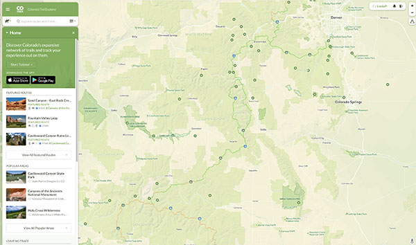
After over two years of planning the Colorado Trail Explorer (CTE) website was launched last year. It is a comprehensive online map of more than 39,000 miles of Colorado trails
This interactive map is a gathering of multi-use trails in Colorado — in a single place. The CTE was developed by Colorado Parks and Wildlife. The trail map is part of past Governor Hickenlooper’s “Colorado the Beautiful” plan which seeks to connect us to open space, public lands and the outdoors. It is hoped that by consolidating trail information in one place it will make it easier to find trail options in your area or at a trip destination.
The GIS mapping team at Colorado’s Parks and Wildlife started this project in 2015. They compiled a list of almost 500 land managers in Colorado, this list was reduced to about 226 and each one on that list gave detailed coordinates for every trail they administer. The CTE does not include a comprehensive collection of Forest Service trails, they are developing their own interactive map.
With a pretty simple interface you can choose from six categories:
- hiking
- biking
- horseback riding
- motocycle
- ATC
- OHV
After you select a category, click on a segment of the trail and you will get clear rules on what usages are allowed. Download the App for your phone and check it out the next time you are planning a trip!
Original article by Jason Blevins, The Denver Post